Resilient Data – Is Your Organization’s Data Wildfire Ready?
November 15, 2023 is GIS Day! This is a day dedicated to GIS professionals and the critical work they provide for our communities, organizations, environment, and world! Make sure to thank your GIS team members for all the work they do!
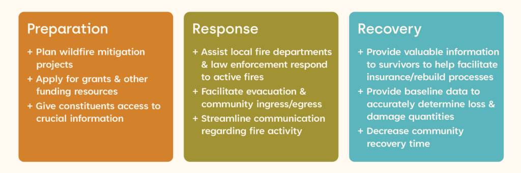
In honor of GIS day, we want to highlight the important role that GIS, particularly spatial data, plays in wildfire preparation, response, and recovery. Like other critical infrastructure and services, you need to devote attention and resources to data to ensure that it is ready to serve your community in the event of a wildfire. In order for our communities to be truly resilient, our data needs to be resilient as well. Resilient data can serve you throughout all phases of your organization’s wildfire planning efforts:
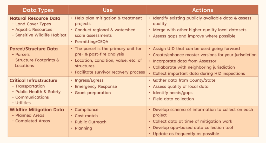
The following table describes common GIS data sets that are important for wildfire planning and community resilience. While your spatial data may already exist in some form, there are many actions you can take to improve and prepare your data to be more resilient in the event of a wildfire.
If you are interested in learning more about how your organization can prepare your spatial data to help make your community more wildfire resilient, our GIS experts and Community Resilience team would love to talk! A little preparation can go a long way and we want to share the lessons we have learned through working on numerous wildfire preparation, response, and recovery efforts.
Click here to download our helpful Resilient Data Flyer and learn how our experts are making a positive lasting impression!
WRA Contact:

Peter Kobylarz, GISP
kobylarz@wra-ca.com