GIS Day 2024 – Meet the WRA GIS Team
November 20, 2024 is GIS Day which recognizes innovative applications of geographic information system (GIS) technology in the environmental field. At WRA, we have a team of Certified GIS Professionals who support nearly every project that comes our way. Our GIS team members are experts in applying the tools and spatial data that comprise GIS to deliver real-world insights and problem-solving for our clients and the communities we live and work in.
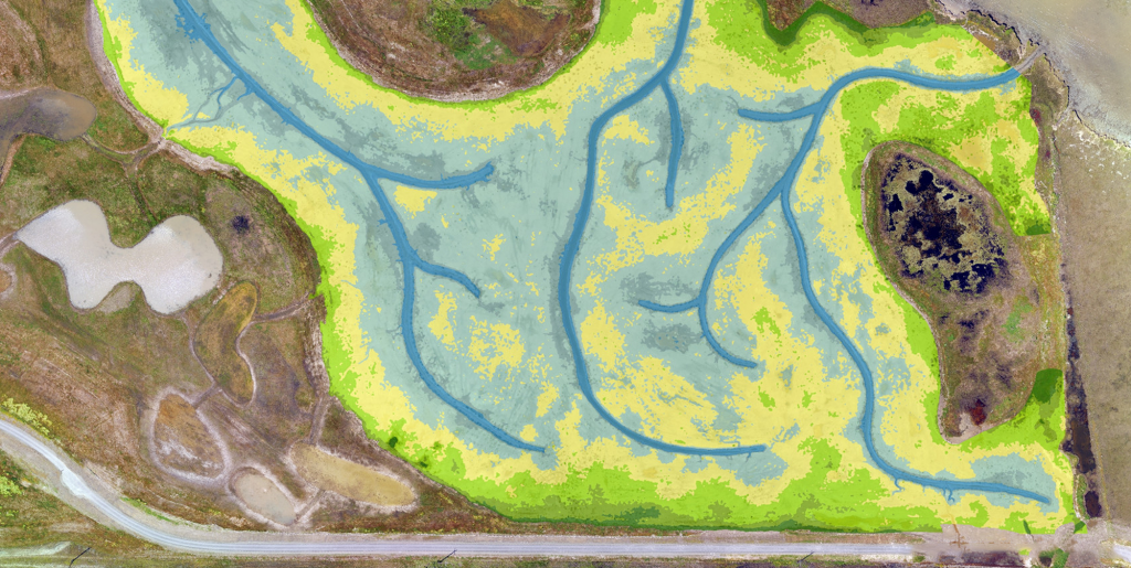
GIS is an essential component of the services we provide at WRA. Despite its critical role, the magic of GIS happens largely behind the scenes. That’s why GIS Day represents an opportunity to recognize the important contributions GIS analysts bring to our profession, from spatial data management to raw imagery processing and analysis, to custom spatial tool development and deployment, to the production of rich and informative visual map products, and beyond.
Meet our GIS crew and learn more about their great work and contributions to WRA and our clients and projects. The spatial data you create, maintain, and analyze helps to translate complex geographic questions into meaningful and understandable visual results.

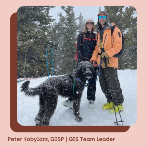
I’ve been a GIS Professional for nearly my entire career, spending 7 years at Mono County helping to manage the County’s Enterprise GIS, and the last 10 years at WRA as GIS Team Leader. I live in the Denver area with my wife Danielle, our 7 month old daughter Lily, and our dog Cooper.
Q1: What is or has been the most impactful project you have worked on at WRA and why?
PK: I’ve had the opportunity to work on a number of large post wildfire recovery projects, including the 2017 North Bay Fires, the 2018 Camp Fire, the 2020 Labor Day fires in Oregon, and the 2023 Maui wildfires. Our work directly benefited wildfire survivors in our communities by using GIS data and analysis to provide data driven evidence that helped facilitate claims and lawsuits against utilities and other parties responsible for starting these fires. It is easy to feel helpless in the climate change affected world we live in, and these projects allowed me to do something that made a tangible difference.
Q2: What current or emerging GIS technology or trend is inspiring to you in your field of work?
PK: Earth observation technology (satellite/orbital instruments, high-tech fixed wing based sensors, UAVs, etc.) is currently undergoing a quantum leap and the volume of earth data of all kinds being generated every day is increasing exponentially. GIS professionals need to develop skills and tools to help them harness and use this data at all different scales. I recently completed a graduate certificate program in Earth Data Analytics from CU Boulder Earthlab in order to help develop programming and data science skills that I intend to use to further our conservation and restoration efforts at WRA.
Q3: Where will we find you outside of work?
PK: Drinking beer on a sunny patio with my friends and family, foraging for wild mushrooms in the Front Range/Rockies/Northern California, or riding my bike and skiing as often as I can get away with.

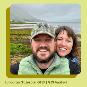
This November marks my 19th year working at WRA. After graduating from the University of California Santa Barbara, I was hired straight out of college by WRA. Over the last two decades, I have worked on a wide array of projects all over the state. Primarily a GIS analyst, I also work as a plant and wildlife biologist. I founded WRA’s UAV program and have spearheaded the use of this new field of technology. I now live with my girlfriend Sinead in the west of Ireland in Lahinch, County Clare.
Q1: What is or has been the most impactful project you have worked on at WRA and why?
SG: From 2010 to 2017 I had the privilege of working on the Jack and Laura Dangermond Preserve (formerly Cojo-Jalama Ranches). I performed field surveys of the entire 24,000-acre property mapping all of the land cover types and cataloging all rare plant occurrences. My years of work led to the creation of the baseline biological dataset for the entire property. The preserve is one of the greatest success stories for preservation in California’s history. I am very proud my hard work continues to be used in understanding the complex biological diversity of the property.
Q2: Do you participate in an industry organization? If so, how does your participation enrich your career and/or work?
SG: For the last decade I have been an active member of the California Society for Ecological Restoration (SERCAL). I have presented at the conference 6 times and have acted as a mentor to new emerging restoration specialists in the field. The annual conference is a great opportunity to share restoration practice insights and learn from each other in the field who are dedicated to helping restore wild spaces in CA. Check out their website!

I’ve worked 18+ years at WRA coming straight out of college at San Francisco State University with degrees in Geography and Environmental Science. In addition to working on the typical GIS project needs I’ve also focused on automating, innovating, and improving what WRA’s GIS team can offer. I worked out of the company’s San Rafael office for 12 years, but currently reside in Tucson, Arizona with my wife Jill and our rescue animals, which currently consists of our betta Penny and rabbits Kip and special needs Bella.
Q1: Tell us about a model, workflow, or tool you have built or customized for WRA and how that has changed the way WRA does business.
MR: Cowpacity is a model I developed early on in my career at WRA that automates the calculation of livestock stocking rates in AUM. This is just one of the tools I developed to enhance the value of GIS at WRA and offer innovative services for our clients. I’ve also automated our workspace creation and templates for data, processing of DEMs for fieldwork and analysis (if you haven’t heard of a depression extract then please inquire), and many other tools.
Q2: How have you seen GIS change in your career while at WRA and how have you adapted this as part of your work?
MR: The biggest adaptation over my career was the transition from ArcMap to Pro and AGOL Field Maps. AGOL Field Maps has really transformed everything for field collection and just how easy it is to get data viewers online. Back in the day, you had to be an expert in programming and HTML in order to publish maps, now I could teach you in a half hour. Thanks to Peter for making this transition happen smoothly!
Q3: Where will we find you outside of work?
MR: The picture of my wife and I was in Vienna last summer, we did a 4-country river cruise on the Danube where you are on bike during the day. We love to travel and to stay active. When in Tucson, on the weekends, you will probably find us hiking amongst the Saguaros, cycling on Tucson’s Loop, at the gym, some funky cold plunge and sauna place, and out devouring local cuisine.

I have been a fan of the natural world ever since I was a young kid catching tree frogs in the Pacific Northwest. In my career so far, I have worked for a Tribal government, served as a Peace Corps volunteer in Mexico, and did a stint at the National Park Service before starting at WRA as a GIS Analyst in 2018.
Q1: Tell us your thoughts on the importance of GISin the context of WRA’s work in the environmental consulting industry.
A: In today’s data-rich business landscape, having access to the most recent data to inform decision-making is important to all of our projects. The tools of GIS allow us to overlay and visualize data coming from so many sources, everything from national-level hydrologic boundaries down to CAD drawings and field-collected points. GIS allows WRA to be responsive to client needs, giving them the information they need in a format that is accessible and reduces confusion.
Q2: What advice would you give to the next generation considering entering the GIS field?
A: To those interested in starting out in the GIS field, seek out an internship or volunteer your time. Find a place where you can be involved in the whole process from collecting data in the field all the way to conducting analysis and producing figures. Seek out skill-building opportunities in data analysis and data science and learn the basics of how to clean up messy data as you’ll be getting a lot of it throughout your career. Attend conferences as often as possible and talk with people about the challenges you face in your work. The GIS community of practice is eager to help new folks find their way.
Learn more about WRA’s GIS capabilities here.


