About Us
We’re here to make a positive lasting impression.
Our Board is invested and committed to a sustainable future
WRA is governed by a 7-member Board of Directors comprised of WRA staff and external Board Members. The Board represents the company’s shareholders and creates and maintains the company’s governance structure, shareholder investment integrity, and strategic guidance for sustainable company growth.
Geoff Smick is WRA’s Chief Executive Officer. He has served on WRA’s Board of Directors since 2010 during which time he contributed to numerous committees related to company strategy and governance. He has supported the Board’s transition to including external Directors which provides the company with additional breadth and expertise. In his day job, Geoff leads WRA’s Executive Team in implementing the company’s strategic plan while continuing to advise clients on ecological and regulatory matters. Geoff joined WRA in 2005 as a botanist and worked his way up through the company as a project manager and into company leadership. An ecologist and regulatory specialist by training, Geoff still works closely with clients to help them solve complex regulatory issues on their projects.
Geoff earned a Bachelor of Arts in Biology with Honors from the University of Oregon and a Masters degree in Ecology and Systematics from San Francisco State University. He is involved in several professional organizations including serving as the Treasurer and Board Member for the California Society for Ecological Restoration (SERCAL).

Leslie Allen is a Principal with WRA and leads one of the company’s project delivery teams. She brings extensive experience working in the public and private sectors. Leslie specializes in managing multidisciplinary teams to support clients through complex environmental permitting, mitigation, and monitoring efforts in the greater San Francisco Bay Area. The technical skills that Leslie developed earlier in her career as a field biologist, wetland delineator, and construction monitor inform her approach to navigating environmental compliance and the relationships among regulators, project proponents, construction contractors, and other stakeholders. Leslie is experienced with managing projects from conception to completion. She also is adept at picking up projects where others have left off and getting them to construction. Leslie manages preparation of project-specific permit applications, consultation packages and mitigation plans to satisfy regulatory agencies at the federal, state, and local levels. Leslie also handles permitting and compliance with local ordinances that protect streams, wetlands, and trees.

Throughout her career as a leader in the AEC industry with established firms (AECOM, JLL, and Cuningham Architecture Group), Jacqueline Dompe has designed, initiated, and led strategies for private and public sector market expansion, business development, revenue growth, and business transformation as well as for advancing business cultures and employee engagement, especially during times of rapidly changing commerce landscapes. Her successes span over multiple priorities (progressive strategies, alliance building, mergers and acquisitions (M&A), organizational development, improved valuation, and more) – all leading to increased margins, improved operational efficiencies and more collaborative workplaces where commitment to organizational purpose, respect, inclusion, dignity, and performance are paramount.
Dana McGowan is a professional archaeologist with over 40 years of experience managing environmental analysis and documentation for complex projects, and the development and implementation of environmental documentation and implementation programs. She’s an expert in the National Environmental Policy Act (NEPA), California Environmental Quality Act (CEQA), and Section 106 of the National Historic Preservation Act (NHPA) compliance. In addition to her consulting experience as a vice president and cultural resources practice leader, Dana has served as Cultural Resources Manager for the California High-Speed Rail Authority. She has served in key roles on many other high-profile public agency projects including San Francisco Transportation Authority’s Doyle Drive Project in the Presidio, the Los Angeles Department of Water and Power’s Owens Lake Dust Control Mitigation Project, and the Bay Delta Conservation Plan. Dana brings strategic planning insights to WRA’s Board in areas including new services and geographic expansion along with an understanding of recruiting and training needed to service these growth areas.
Matt Osowski serves as the Chair of WRA’s Board of Directors. With WRA he is an integral part of the company’s regulatory team and serves as the company’s Health and Safety Officer. Matt’s goal over his career in environmental consulting is to provide competent, reliable solutions on time and under budget. His work in compliance and permitting focuses on larger, long-term projects with multiple private and public stakeholders. As a Regulatory Permitting Specialist at WRA, he negotiates with multiple agencies having disparate needs on behalf of project stakeholders.
Matt earned a Bachelor of Science in Biology at Loyola University of Chicago, where he studied coastal ecology and conservation on Vancouver Island, BC through Boston College. He is certified in GIS through San Francisco State University, and has studied the wetland ecology of California since 2002.
Recent Projects
Rob Schell is WRA’s Wildlife and Fisheries Director and brings nearly two decades of technical, scientific and industry experience to his Board seat, along with his company tenure since 2007. Rob puts collaboration and innovation first in his approach to managing projects and people. He is committed to finding elegant, evidence-based solutions to complicated regulatory and wildlife management issues in order to inform appropriate and contextualized land use decisions.
Rob earned a Bachelors of Science in Evolution and Ecology from University of California, Davis and is active in the study and conservation of amphibians and reptiles. He also previously served on the Board of Directors for The Biodiversity Group, an organization that focuses on life overlooked. Through his non-profit work, Rob worked to describe new species to science, protect endemic biodiversity, and conserve large tracts of land critical to the survival of endangered species and indigenous people alike.

Trevor is the CEO of The Menke Group and his 20+ year professional background spans entrepreneurship, finance, investment banking, mergers and acquisitions, and valuation for closely held middle market companies with a focus on the A/E/C industry. He enjoys helping both founders and businesses devise strategies for growth and ownership succession. While not strategizing with clients or digging into deal details, you’ll likely find him outdoors—logging miles on the bike or the trail every weekend.
Executive Committee
Our management team puts people first
WRA’s Executive Committee is a small, close-knit group with focus on business, people, marketing, and internal operations to support a healthy, productive team and ensure a great client experience. Represented by the leaders of each of the primary organizational units of the company, the Executive Committee brings subject-matter expertise to the table to support strategic planning and overseeing tactical execution.
Geoff Smick is WRA’s Chief Executive Officer. He has served on WRA’s Board of Directors since 2010 during which time he contributed to numerous committees related to company strategy and governance. He has supported the Board’s transition to including external Directors which provides the company with additional breadth and expertise. In his day job, Geoff leads WRA’s Executive Team in implementing the company’s strategic plan while continuing to advise clients on ecological and regulatory matters. Geoff joined WRA in 2005 as a botanist and worked his way up through the company as a project manager and into company leadership. An ecologist and regulatory specialist by training, Geoff still works closely with clients to help them solve complex regulatory issues on their projects.
Geoff earned a Bachelor of Arts in Biology with Honors from the University of Oregon and a Masters degree in Ecology and Systematics from San Francisco State University. He is involved in several professional organizations including serving as the Treasurer and Board Member for the California Society for Ecological Restoration (SERCAL).

Pema Lin is WRA’s Vice President, People Operations. She has broad experience in recruiting and human resources (HR) across a variety of industries. Her expertise in HR is wide-ranging, encompassing HR strategies development, technology, operations, talent acquisition, employee and team development, and culture development. Pema earned her Master’s of Theological Studies degree in Buddhist Studies from Harvard Divinity School and her Bachelor of Arts in International Studies and Religious Studies from the University of Richmond. In 2021, Pema became a certified integral coach through New Ventures West.
Bianca McCarron is WRA’s Vice President, Finance. She has comprehensive financial and operational experience in both the consulting and construction sectors. Bianca has successfully led teams through ownership transitions, process improvement, and growth. At WRA, Bianca’s responsibilities include leading financial planning, policy, and investor relations, as well as liaising with the senior leadership and the company’s Board of Directors to maintain fiscal health and compliance. She also develops forward-looking, predictive models and analyses to provide insights into WRA’s operations and business plans. Bianca earned a Bachelor of Science in Accounting from California Polytechnic State University in San Luis Obispo and is a certified public accountant (CPA).
Janet Klein
Janet Klein is WRA’s Director of Strategic Initiatives and a member of the Executive Committee. She is a conservation ecologist with experience managing public lands and creating partnerships that advance conservation and climate resilience. Her areas of expertise include multi-jurisdictional collaboration, multi-agency systems integration, community and youth-centered engagement, planning for climate resilience, wildfire risk reduction, landscape-scale vegetation management, ecological assessment, and long-term monitoring program design. Janet brings a wealth of public agency experience including her prior tenure with the Golden Gate National Parks Conservancy and Natural Resources and the Marin Municipal Water District.
Aaron Sutherlin, PE
Aaron Sutherlin, PE is WRA’s Director of Project Delivery, a member of the Executive Committee, and leads the company’s Riverscapes & Shorelines practice. He is a licensed professional with comprehensive experience in water resources engineering. Aaron is currently completing his Master’s in Engineering Management from the University of Colorado – Colorado Springs. He has a broad background in managing complex ecological restoration, flood control, and watershed projects from inception to completion, including dozens of projects across the country working with numerous local, state, and federal agencies and various private landowners and nonprofit organizations. Aaron provides extensive knowledge in design and construction working with open channels, riparian corridors, and infrastructure protection. He brings expertise and passion for watershed protection, ecological restoration, and community resilience work.
Principals, Directors, and Team Leaders

Liz Agraz is WRA’s Marketing Director. She has vast experience in a diverse range of marketing professional services for the architecture, engineering, and construction (A/E/C) industry for public sector and private clients throughout the western United States. At WRA she contributes to strategic initiatives, competitive pursuits, and communications. Liz provides a broad range of marketing services to support WRA’s market and practice leaders while balancing emerging trends and policies including technology, funding, and delivery methods. Liz earned her Bachelor of Arts degree in Journalism from James Madison University. (SERCAL).
Marisa Ishimatsu leads WRA’s compliance monitoring team. She is WRA’s expert in permit implementation and serves as project manager assisting our clients with permit interpretation, agency negotiation, notifications, reporting, and deployment of field staff for pre-construction surveys and construction compliance monitoring.
Marisa has experience working with many California species including Alameda whipsnake, bald and golden eagles, blunt-nosed leopard lizard, burrowing owl, California red-legged frog, California tiger salamander, desert tortoise, flat-tailed horned lizard, giant garter snake, giant kangaroo rat, Mojave ground squirrel, salt marsh harvest mouse, San Francisco garter snake, San Joaquin kit fox, and Swainson’s hawk. Marisa is trained on CPR/AED/First Aid, helicopter safety, all-terrain vehicle, unexploded ordinance (UXO), paleontological and archeological artifact identification, and SWPPP. She has conducted training on rattlesnake handling and avoidance.
Andrew Keller
Andrew Keller has expertise as an ecologist, wildlife biologist, and habitat restoration specialist, supporting a range of organizations in the private, public agency, and non-profit sectors. He specializes in environmental permitting, biological mitigation planning, environmental compliance, ecological restoration, and land use planning in Southern California.
Andrew provides senior oversight and guidance for projects and programs related to biological surveys, mitigation banking, land-use planning, jurisdictional delineations, environmental permitting, and habitat restoration. He has extensive experience in environmental documentation quality control for CEQA and NEPA reporting and provides technical reporting guidance for biological staff.
Hope Kingma is a Principal with WRA and leads one of the company’s project delivery teams. She has vast field experience working as a biologist in a wide variety of habitats, including tidal and diked salt marshes, seasonal wetlands, freshwater marshes, riparian corridors, and non-native annual grasslands. Hope has conducted site assessments and special-status species surveys, including salt marsh harvest mouse, California red-legged frog, California tiger salamander, western burrowing owl, San Joaquin kit fox, harbor seal, and several raptor species.
Hope has extensive experience with wetland permitting pursuant to Sections 404 and 401 of the Clean Water Act. She has prepared endangered species “incidental take permit” applications pursuant to Section 7 of the FESA, Section 2081 of the CESA, and Streambed Alteration Agreement applications pursuant to Section 1602 of the California Fish and Game Code. Hope has conducted numerous wetland delineations and prepared wetland creation and riparian restoration plans, performed restoration and mitigation monitoring, conducted construction monitoring in sensitive habitats, and prepared Biological Resources Analysis Reports supporting the CEQA review of projects throughout the Bay Area, including many projects in the Santa Rosa Plain.
Recent Projects
Peter Kobylarz is a Senior Spatial Data Science Professional with wide-ranging experience in the public and private sectors. He leads WRA’s Geographic Information Systems (GIS) technical team. Beyond the standard map production and geospatial analysis services provided by the GIS team, Peter has used his experience with enterprise GIS technologies and data management to grow the GIS capabilities and services that WRA offers. These supplemental services include UAV/drone mapping capabilities, web and mobile GIS mapping applications, advanced remote sensing data collection and analysis, enterprise GIS planning and implementation, and custom geospatial analysis workflows and models.
Peter delivers a strong combination of Enterprise IT and Geographic Information Systems experience to provide WRA and our clients with valuable spatial data driven solutions and landscape scale problem solving. He has served as the lead GIS Analyst and GIS Project Manager on a number of superlative restoration and resiliency projects throughout California. Peter’s work on wildfire recovery and response in the aftermath of the devastating 2017 and 2018 wildfires in Northern California has helped push the envelope of WRA’s growing resiliency practice and has established Peter’s reputation as a leader in environmental and resiliency GIS in California and beyond.
Leslie Lazarotti is a Principal with WRA and leads one of the company’s project delivery teams. Her main focus is helping clients understand the interface of California’s environmental regulations and natural communities. Leslie has worked on projects throughout the varied ecosystems of California, including sensitive coastal communities and wetland habitats. She specializes in preparing multi-agency permitting approaches for redevelopment projects along San Francisco Bay, infrastructure improvement projects, and open space and park projects with public access elements. Leslie is one of WRA’s foremost experts in California Coastal Zone requirements. Prior to joining WRA, Leslie worked for San Francisco State University, San Francisco Estuary Institute, and the State Water Quality Resources Control Board as part of the 401 Water Quality Certification Program.
Recent Projects
Crystal Mainolfi
Crystal Mainolfi is WRA’s Environmental Planning Director. She is an experienced environmental planning and regulatory compliance professional with a strong background in CEQA/NEPA compliance, land use planning, and biological resource assessments. Crystal demonstrates a proven ability to lead interdisciplinary teams on complex projects from large-scale infrastructure developments to habitat restoration initiatives across California and beyond. She brings a diverse range of skills including environmental impact analyses, stakeholder engagement, and regulatory permitting, to deliver sustainable solutions for her clients.
Prior to joining WRA, Crystal founded and managed an environmental consulting firm specializing in CEQA compliance, NEPA studies, threatened and endangered species consultation, regulatory permitting, and Phase I site assessments. She collaborates effectively with municipal and state agencies, tribal leaders, and private entities to navigate regulatory frameworks and achieve project success.
Matt Richmond is an experienced ecologist with over two decades of experience in the field. He has an extensive background in planning and implementing restoration projects, public access, and open space projects. His expertise spans a variety of habitats, and he has worked with private parties, non-profits, and public agencies to implement restoration and public access projects.
With deep ecological knowledge and a keen understanding of regulatory challenges in California, Matt is a trusted advisor to his clients, offering practical solutions that balance ecological goals with the needs of community partners. He has demonstrated a commitment to sustainable resource management and ecosystem restoration throughout his career. Matt has a proven track record of leading teams to successful outcomes, utilizing his extensive knowledge of plant and animal communities, water resources, and ecological processes. In addition to his technical expertise, he is a skilled communicator, adept at engaging with stakeholders and building consensus around complex environmental issues.

Leslie Scott
Leslie Scott is an effective project manager with vast experience in natural resources management. At WRA-LR, Leslie manages the field crews performing ecological restoration services including native plant out-planting, site maintenance and irrigation, invasive plant mapping and control, stream bank stabilization, erosion control, and fire fuel management. She’s also responsible for data collection for reports and field research, documenting and mapping distributions of native resources and invasive populations for project sites, occasional tool, and vehicle maintenance, and strategically implementing ecologically driven approaches to achieve optimal success on our project sites.
Justin Semion is a Principal and leads WRA’s Technical team. He focuses his work on guiding clients to outcomes that benefit organizational goals and contribute to environmental sustainability. Justin’s background in environmental science and business management provides a unique set of skills and perspectives to assist with integrating the needs of the environment and society into the decisions of private and public organizations. By integrating social and environmental aspects into the decision-making process, project risks and benefits can be better identified and managed to facilitate project approvals.
Justin has worked at WRA since 2001 and during his time he has managed hundreds of diverse projects involving the California Environmental Quality Act (CEQA) and National Environmental Policy Act (NEPA), regulatory permitting, restoration and habitat management, habitat mitigation planning and monitoring, and essential fish habitat evaluation. His broad environmental science expertise includes eelgrass and subtidal estuarine habitats, wetland delineation, ecosystem functions and services evaluation, stream and riparian habitat assessments, rare and endangered species surveys and evaluations, wildlife corridor evaluation, vegetation ecology, and fisheries ecology. He is a well known as an expert on the San Francisco Bay shoreline.

Marlene Tyner-Valencourt
Marlene Tyner-Valencourt has vast experience in environmental consulting, as well as ecological and environmental analysis. She specializes in mitigation banking, mitigation credit sales, market-based conservation strategies, wetland restoration, climate change science, land use planning, and corporate sustainability strategic planning. Marlene is an expert on mitigation banking in southern California and has helped plan mitigation bank projects for public and private sector clients nationally. She has also worked extensively on restoration and ecological remediation strategies for lakes, wetlands, and open spaces affected by extractive land use and pollution. Her diverse experience has given her a thorough understanding of the business and regulatory components of restoration.
Ashley Zavagno is Restoration Ecology Director with WRA and has extensive background in restoration ecology, river and salmonid restoration, mitigation, conservation planning, and land management. As the leader of the Riverscapes and Shorelines Group, she is growing an interdisciplinary team of engineers, landscape architects, ecologists, fluvial geomorphologists, and fisheries biologists to help expand the pace, scale, and ecological impact of WRA’s river restoration projects. Ashley also currently manages several large mitigation banks with an emphasis on those that restore rivers and salmonid habitat. She brings her strengths in strategic decision-making, incorporating current scientific knowledge into restoration and mitigation projects, and navigating complex regulatory pathways to all her projects.
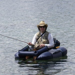
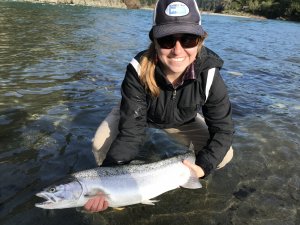
She holds certifications from the Society of Ecological Restoration, Ecological Society of America, and Portland State University River Restoration Professional Program and is a current board member for the California Society of Ecological Restoration (SERCAL). She is a strong advocate for process-based river restoration approaches and landscape-level restoration planning. She is also an active participant in restoration conferences including Salmonid Restoration Federation’s annual conference and Coho Confab, SERCAL, and River Restoration Northwest. When not working, Ashley can be found fly fishing for trout and steelhead at any one of her favorite rivers.